
View the Connected Communities Plan!
The Final Connected Communities Plan was adopted on February 22, 2024!
Tolowa Dee-ni’ Nation
The Tolowa Dee-ni’ Nation is a federally recognized Indian Nation whose original territory is comprised of the lands and watersheds within Del Norte and Humboldt County in California. The Tolowa people have lived along the coast of the Pacific Ocean and the river valleys inland of what is now Northern California and southwestern Oregon. The Nation’s reservation lands and federally recognized jurisdiction is comprised of 9,608 square miles and operates from the Nation’s headquarters near Smith River, California.
Connected Communities Plan
The Connected Communities Plan consists of a study of current infrastructure and mobility challenges. The Plan is intended to improve the lives, safety, and prosperity of the Nation and visitors. The Nation is lacking walking and biking infrastructure and mobility training programs; through the Caltrans Sustainable Transportation Planning Grant Program, the Nation will be able to identify solutions to these challenges based on existing and future land uses and travel patterns.

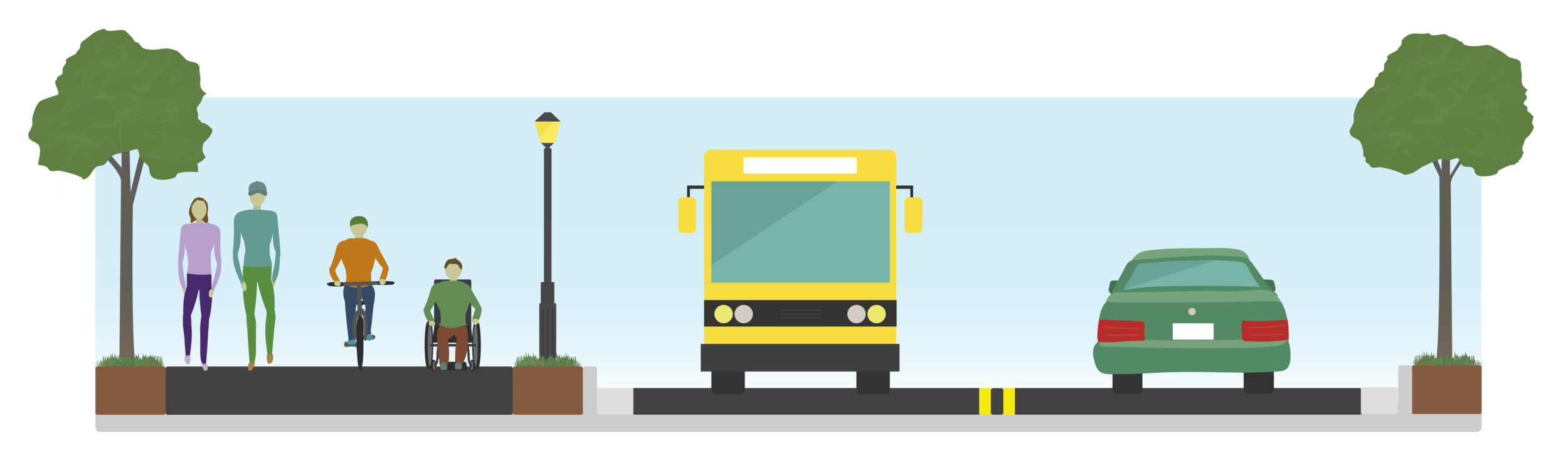
Example of a Class 1 Multi-Use Path (Cross section showing a Multi-Use Path on the left with pedestrians, bicycles, and wheelchair users. A bus and a car are in the driving lanes on the right. The two are divided by a space containing landscaping and lighting fixtures.)
Project Goals
Identifying creative improvement solutions to multi-modal infrastructure
Evaluating existing transportation conditions, safety issues, incomplete network infrastructure
Fostering community participation throughout the development process to implement the community vision into the design concept
Implement long-term educational programs that will educate and encourage community members and visitors to utilize the infrastructure improvements
Preparation of conceptual alignment and cross sections for planned improvements
Improve safety, comfort and convenience for non-motorized modes
Improve livability and promote active living for the Nation and visitors
Prepare preliminary environmental constrains and identify potential challenges to project design and budget
Develop comprehensive funding and implementation strategies
Enhance connectivity and multi-modal transportation options
Preserve and enhance the historic, cultural and rural character of the community
Project Need
The Connected Communities Plan is a necessary step leading to the implementation of multi-modal improvements for the Tolowa Dee-ni’ Nation and visitors. The Plan will improve safety for all modes and encourage bicycle, pedestrian and transit use. The Plan will contribute to the regional and State goals of reduced greenhouse gas emissions, improved air quality and improved public and community health.
With 1,850 enrolled Tolowa citizens, 284 (15.3%) live on Reservation land within a mile of the project area. The Reservation consists of Tribal housing communities along a 1.5 mile stretch of Highway 101 to Smith River. The Nation is in the process of a community expansion of Tribal properties and the Plan will allow the Tribe to progress its current infrastructure.
Multi-Use Path & Complete Street Benefits
HEALTH: Prevent diabetes, heart disease, arthritis, obesity and cancer. Increase social interaction, energy levels and muscle tone. Reduce tension, body fat levels, anxiety, depression and emissions.
SAFETY: Decrease pedestrian and bicycle injuries, collisions and fatalities by limiting interactions with and proximity to vehicular traffic.
TRANSPORTATION OPPORTUNITIES: Promote non-motorized transportation as a priority in San Andreas.
TRANSPORTATION EQUITY: Meet the needs of the transportation disadvantaged, including youths, elderly, persons with disabilities and the economically disadvantaged.
ACCESSIBILITY: Increase access to employment, education, medical, recreation and transit centers.
more Information
Existing Barriers to Mobility

Figure 1: Indian Rd and US. 101
Non-existent bicycle facilities create unsafe conditions for bicyclists

Figure 2: US 101
Small shoulder and lack of sidewalk poses a collision threat to pedestrians and bicyclists

Figure 3: Aerial view of existing street facilities
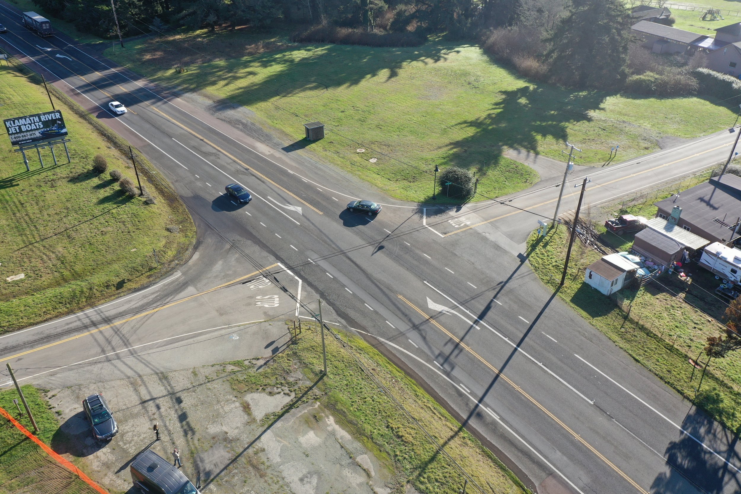
Figure 4: Intersection of two streets
Wide intersection lacks pedestrian and bicycle facilities